 Topographic maps use lines called "contour lines" to show detailed and accurate graphic representation of cultural and natural features on the ground. They use 3-D images to effectively portray an idea on a 2-dimensional surface. It characterizes the ground by large-scale detail and quantitative representation of relief using contour lines in mapping. They visualize natural and man-made features.
Wednesday, December 2, 2009
Topographic Map
Topographic maps use lines called "contour lines" to show detailed and accurate graphic representation of cultural and natural features on the ground. They use 3-D images to effectively portray an idea on a 2-dimensional surface. It characterizes the ground by large-scale detail and quantitative representation of relief using contour lines in mapping. They visualize natural and man-made features.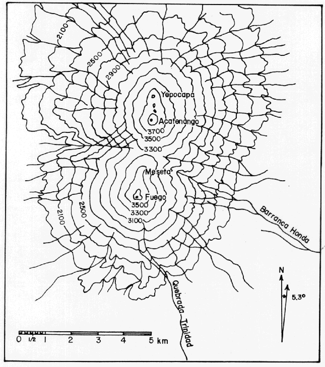
Subscribe to:
Post Comments (Atom)
No comments:
Post a Comment